

17 Oct Ancestry- Newsletter- October 17, 2026
ANCESTRY- THE NEWSLETTER PODCAST STYLE!
You can now listen as well as read the Dancestors Genealogy Newsletter.
Listen to all Dancestors Genealogy newsletters on our podcast page.
PODCASTS
 GPS AND YOUR HIPPOCAMPUS
 GPS AND YOUR HIPPOCAMPUS
===============
For most of human history, getting lost could kill you. When I discover the journeys that our ancestors took, it makes me think of the extraordinary navigational skills they had, whether it was Hezekiah Starbuck sailing from Nantucket to the Pacific for 5 years- see below, Henry Adams following the Preston Trail Preston or Benjamin C. Franklin making his way up the Natchez Trace Trace, they all had to navigate by map, use stars and the sun, follow a trail sign, or use a gut sense of direction.
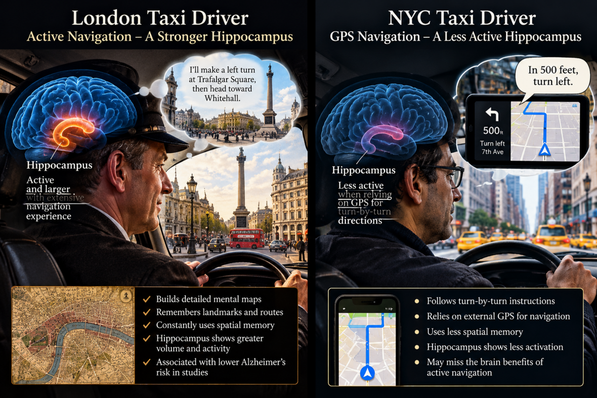
I’ve always been a “maphead”, and when I joined scouts, I was already familiar with topographic maps, and before long I was leading the troop on hikes, and then eventually planning the hikes for the troop. To this day, I enjoy planning trips, even though it takes some time.
Long before road signs, printed maps or satellites, humans survived by constructing maps inside their heads. Hunters had to remember where herds migrated, where rivers could be crossed, and how to return to camp. Travelers followed trails established by Indigenous peoples and earlier generations, orienting themselves by mountains, coastlines, streams, distinctive trees, the sun and stars. Later, we transferred some of that knowledge onto paper maps—but the traveler still had to determine where he was and how the surrounding landscape corresponded to the map.
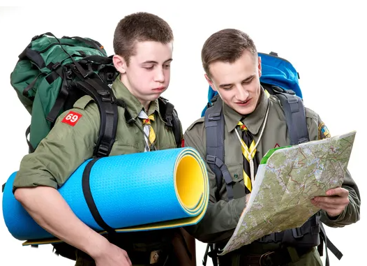
At the center of this remarkable ability is the hippocampus, a brain structure deeply involved in spatial memory and navigation. And an extraordinary natural experiment in London shows just how adaptable it can be.
London’s traditional black-cab drivers must master “The Knowledge”—a mental map encompassing roughly 25,000 streets and tens of thousands of landmarks. Candidates spend years traveling the city, studying maps, visualizing routes and learning to navigate between locations without depending upon turn-by-turn instructions.
When neuroscientist Eleanor Maguire studied their brains, she discovered something remarkable: experienced London taxi drivers had greater gray-matter volume in the posterior hippocampus, and the difference was associated with years spent navigating. Later comparisons with London bus drivers were especially revealing. Bus drivers also spend their working lives driving but generally follow predetermined routes; they did not show the same pattern.
In other words, the important activity appears not simply to be traveling. It is figuring out where you are and deciding how to get somewhere.
That raises a fascinating question about GPS. For thousands of years, ordinary travel constantly exercised this system. Even after maps became commonplace, we still looked for landmarks, remembered turns, estimated direction, and maintained a mental picture of our surroundings. GPS can now do much of that cognitive work for us. “Turn right in 500 feet” requires remarkably little understanding of where we actually are.
Could abandoning that mental exercise have consequences? Here the science becomes tantalizing—but we need to be careful. A remarkable 2024 study examined nearly nine million U.S. death records across 443 occupations. Taxi and ambulance drivers—jobs historically requiring constant, unpredictable navigation—had the lowest adjusted proportions of deaths attributed to Alzheimer’s disease. Taxi drivers were about 1.03%, compared with an adjusted 1.69% in the overall population. The same pattern did not appear among transportation workers following more predetermined routes. Brains/
That does not prove that navigation prevents Alzheimer’s, nor does existing research show that GPS use is causing the disease. The researchers themselves describe the finding as hypothesis-generating rather than causal. Other differences between occupations could contribute to the result. It appears the London cabdriver is using his hippocampus more than the NYC cabdriver who’s mostly honking.
But the connection is intriguing because the hippocampus is also among the brain regions affected early in Alzheimer’s disease. The same structure humans have relied upon for countless generations to answer Where am I? Where am I going? How do I get home? is a structure capable of changing in response to navigational demands.
Perhaps there is a lesson here. GPS is an extraordinary tool, and no one needs to throw it away. But occasionally, navigating by landmarks, studying a map before leaving, learning unfamiliar streets, remembering routes, and asking ourselves which direction we’re traveling may be more than a nostalgic exercise.
For our ancestors, exercising the brain’s internal compass was unavoidable. For us, it may have to become a choice, so instead of handing it all over to AI, I’ll try to keep my hippocampus from becoming useless or even contributing to disease.

THE GHOST RESORT OF THE GRAND CANYON
 THE GHOST RESORT OF THE GRAND CANYON
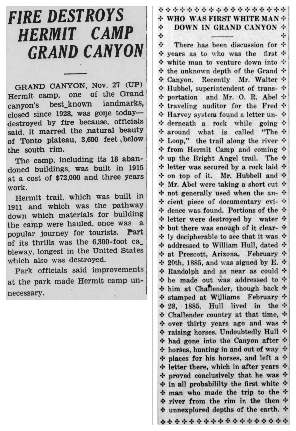
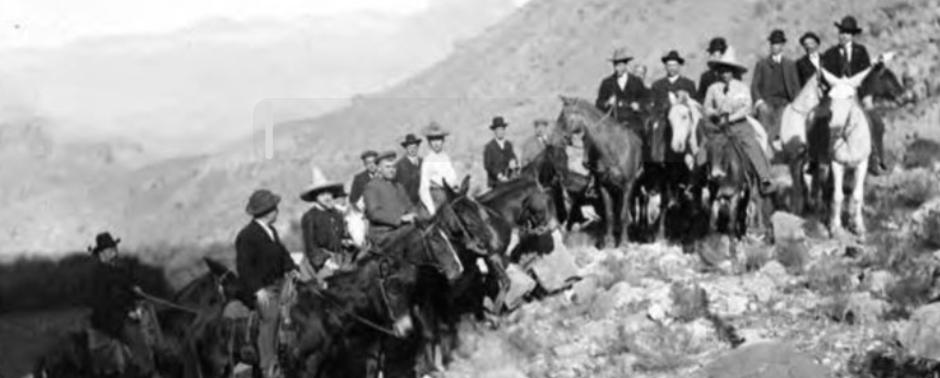
Speaking of scouts and leading with maps, in the early 1970s we hiked down into the Grand Canyon on the less-popular Hermit Trail (vs. Bright Angel and Kaibab) and camped at Hermit Creek Falls. Above the falls was a sort of mesa, and on it were the remains of a Fred Harvey resort.
I recently researched the place and found out that it was known as the legendary Hermit Camp, a luxury wilderness resort built deep inside the Grand Canyon on the Tonto Platform.
Operated by the Fred Harvey Company in partnership with the Santa Fe Railroad, it opened in 1912. It predated the famous Phantom Ranch by a decade and was widely considered the absolute height of “glamping” for its era. The Luxury Oasis in the Desert. While Phantom Ranch is rustic, Hermit Camp was pure Edwardian luxury dropped into the backcountry.
For about $100,000 (an astronomical sum at the time), they built a resort that featured: Elevated canvas tent cottages complete with hardwood floors, rugs, real furniture, and windows. Unbelievably for the 1910s inner canyon, the camp had electricity, running water, flushing showers, and telephone service connected to the South Rim. Guests didn’t eat camp food; a Fred Harvey Company chef was stationed at the camp’s stone dining hall, serving fresh meat, fruit, vegetables, and ice.
They disassembled a fully functional automobile, packed it down the cliffs on mules, reassembled it on the Tonto Platform, and used it to drive guests around the flatter parts of the inner canyon.
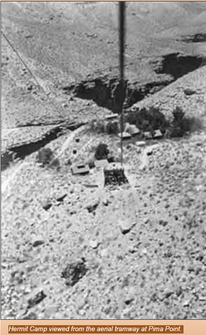
Originally, everything had to be packed down the Hermit Trail via mule trains. To make the camp’s operations vastly more efficient, the Santa Fe Railroad built an aerial tramway called The Pima Point Cable Tramway, in 1925 that ran from Pima Point on the South Rim straight down to the camp (see picture). The cable line dropped thousands of vertical feet into the abyss. A large metal cargo basket traveled along the cable line, drastically speeding up the delivery of fresh linens, ice, fine dining ingredients, and daily camp supplies.
Hermit Camp was wildly successful for nearly 20 years. However, in the late 1920s and early 1930s, the National Park Service took control of competing trail systems on the South Rim and consolidated its inner-canyon tourism efforts around Phantom Ranch.
The railroad and Fred Harvey Company officially closed Hermit Camp in 1930. In 1936, the National Park Service ordered a complete cleanup of the site. The buildings were systematically dismantled or burned, and the massive aerial cable tramway was completely dismantled to restore the canyon to its natural state.
The trail closed in 1983 due to a landslide but has more recently reopened; landslides can occur at any time. If you hike the Hermit Trail today, you can still explore the historic ruins of Hermit Camp. The old concrete building foundations, stone pathways, an underground cold-storage cellar, rusted relics, and the heavy iron anchors of the lower tramway terminus are all still visible, scattered across the desert landscape.
However, back when we were there, the remains of the Ford Model T were still present, minus tires, and someone had removed the steering wheel. Sporadic cables and pulleys remained on the ground. There were piles and piles of old colored glass jars that we rummaged through. I remember one of the scoutmasters’ promised kids that if they would carry stuff out for him: a Big Mac, fries, and a Coke, a king’s ransom awaited them on the way home. So, one kid had a big coal bucket strapped to his pack, maybe he got a hot apple pie?
We stayed there four nights. We slept under the stars, and our former Canadian forest ranger, failed stockbroker, and excellent scoutmaster led us through the constellations each evening.
We spent another night at Monument Creek, where we encountered hippies, and even better for young teen boys, naked girl hippies in the stream. We were quietly observing our first real bare-naked ladies from a small bluff, when one of the scoutmasters came up and chased us out of there. Coincidentally, it took him a while to get back to camp. It was the coal bucket guy, not the ex-forest ranger.
I remember hiking out of the canyon up the very steep south rim, hungry, thirsty, and exhausted. I got to the top, and there was a snack bar. For my entire fortune of $1.25, I got a chocolate shake and a hot dog that I can still taste today.
In my most recent visit, there were no more naked hippies, the snack bar had a long line, and the same meal cost $14. Time marches on!
PIRATES, PASTORS, POETS AND PASSION
 PIRATES, PASTORS, POETS AND PASSION
In the last edition I covered Jans Janszoon’s adventures in Salé and Lundy. Here is more on his adventures.
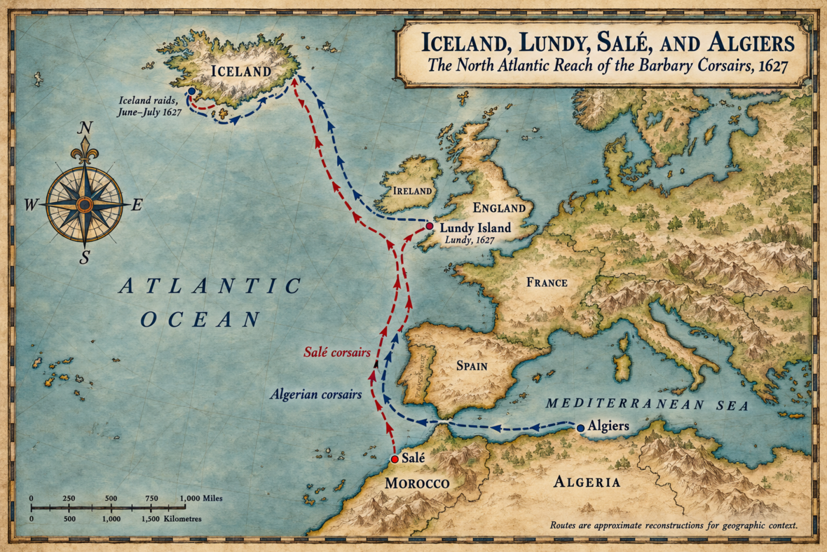
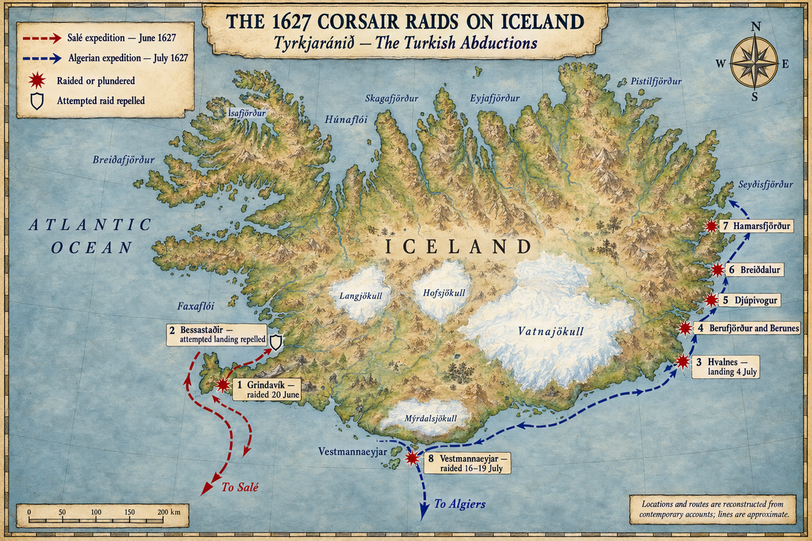
In 1627, Janszoon used a Danish “slave” (most likely a crew member captured on a Danish ship taken as a pirate prize) to pilot him and his men to Iceland. There they raided the fishing village of Grindavík. Their takings were some salted fish and a few hides, but they also captured twelve Icelanders and three Danes. When they were leaving Grindavík, by means of flying a false flag they managed to trick and capture a Danish merchant ship that was passing.
The ships sailed to Bessastaðir, seat of the Danish governor of Iceland, to raid, but were unable to make a landing – it is said they were thwarted by cannon fire from the local fortifications and a quickly mustered group of lancers from the Southern Peninsula. They decided to sail home to Salé, where they sold their captives as slaves.
Two corsair ships from Algiers, possibly connected to Janszoon’s raid, came to Iceland on 4 July and plundered there. Then they sailed to Vestmannaeyjar off the southern coast and raided there for three days. This raid was known in Iceland as Tyrkjaránið, “the Turkish Abduction”, as the Barbary states were nominally a part of the Ottoman Empire.
Accounts by enslaved Icelanders who spent time on the corsair ships claimed that the conditions for women and children were normal, in that they were permitted to move throughout the ship, except to the quarterdeck. The pirates were seen giving extra food to the children from their own private stashes. A woman who gave birth on board a ship was treated with dignity and afforded privacy and clothing by the pirates. The men were put in the hold of the ships and had their chains removed once the ships were far enough from land.
Despite popular claims about the treatment of captives, Icelander accounts do not mention that slaves were raped on the voyage itself, the fate of the captives was quite dim and as many as 100 perished from disease or injury either before or shortly after arriving in Africa, with all being sold into slavery upon arrival, many of whom suffered under brutal conditions. It is estimated that less than 50 ever regained their freedom.
However, Guðríður Símonardóttir Guðríður the wife of a fisherman (Eyjólfur Sölmundarson), living at Stakkagerði in the Westman Islands. Following her abduction in 1627 from the Westman Islands, she was sold by the pirates as a slave and concubine in Algeria. In 1631, while still enslaved, she sent a letter to her husband in Iceland, who had escaped from the pirates and still lived in the Westman Islands. Guðríður was among the few who were ransomed nearly a decade later by King Christian IV of Denmark, although she had also managed to save some money towards purchasing her freedom. Her young son, who was captured at the same time, remained in Algeria.
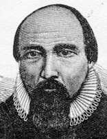
After being freed, Guðríður was sent to Denmark along with a group of other former slaves to be re-educated. They were taught by Hallgrímur Pétursson (pictured), then a theology student. They fell in love and she became pregnant by him. They returned to Iceland where she learned that her first husband, Eyjólfur, had died. Their son Eyjólfur was born in 1637, and she and Hallgrímur married in 1638. The couple had two other children, both of whom died in childhood: Guðmundur and Steinunn.
Although his studies abroad ended when Guðríður became pregnant, Hallgrímur was ordained as minister for Hvalsnes in 1644 and later was called as the pastor of a church at Saurbær, Iceland (1651–1669). He became well known for his poetry and especially what are known as Passion Hymns (Passíusálmar), recounting the life and death (The Passion) of Christ.
Very little is known of Guðríður after her return to Iceland, but in later reception she became known by the derogatory nickname Tyrkja-Gudda, and various claims were made in folktales, including that she was a hag who seduced Hallgrímur and kept Muslim idols in secret, which Hallgrímur burned upon discovering them. Sigurður Nordal wrote an early defense of Guðríður Símonardóttir, pointing out the absurdity of claiming that a Muslim would own — much less worship — idols, and more recent depictions of Guðríður and her life have been overwhelmingly positive. Dagný Kristjánsdóttir argues that later legends about Tyrkja-Gudda have little to do with the actual historical person of Guðríður herself, instead warping her into a fantasy of the exotic and foreign world of Barbary as imagined in Iceland.
THE DANGEROUS WOMAN WHO BUILT BROOKLYN
 THE DANGEROUS WOMAN WHO BUILT BROOKLYN
History books are filled with the names of men who carved out settlements in the New World, but one of the most successful colonies in early America was founded by a woman the Puritans deemed too dangerous to keep. Her name was Deborah, Lady Moody, and she remains the only European woman known to have founded a settlement in North America, as well as the first known female landowner in the New World.
But she didn’t conquer the wild frontier of Long Island alone. To survive, she had to build an alliance with another famous outcast: a notorious Moroccan-Dutch farmer named Anthony Van Salee Van Salee .
Born into wealth in London in 1586, Deborah Dunch was the daughter of an auditor of the Royal Mint and a bishop’s daughter. She married Sir Henry Moody, earning her title, but after his death in 1629, she chose a path far more radical than that of a typical English dowager. Seeking religious freedom, Lady Moody emigrated to Massachusetts in 1636. She was an Anabaptist (discussed in our January 2025 edition) Anabaptist and a Nonconformist, openly opposing the practice of infant baptism. In a strict Puritan colony that demanded absolute conformity, her vocal beliefs and independent wealth quickly made her a target.
Her neighbors grew nervous, and Puritan leader John Endecott openly branded her a “dangerous woman”. Put on trial for religious dissent in 1643, she was given an ultimatum: recant her beliefs or face excommunication. Lady Moody chose excommunication. The Lady refused to be silenced, and Lady Moody gathered her followers and headed south into Dutch-controlled territory.
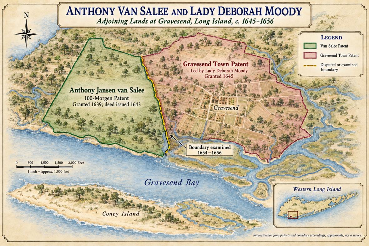
The Dutch West India Company, seeking wealthy settlers to defend and populate the southwestern tip of Long Island, granted her a patent for land. When Moody arrived to claim her territory in 1643, she found her land grant positioned directly adjacent to Anthony Van Salee. Van Salee, popularly nicknamed “The Turk,” was a giant of a man, a wealthy farmer of Moroccan-Dutch descent (see map below). Like Moody, he was a total outcast. He and his feisty wife had been legally banished from Manhattan by the colonial government for public squabbling and refusing to pay mandatory Dutch church fees.
On paper, they were total opposites—an aristocratic English noblewoman and a rough-around-the-edges Moroccan frontier farmer. But as mutual exiles on the edge of the colony, they formed a highly functional, peaceful relationship. While Van Salee was notoriously litigious and constantly sued almost everyone else in New Netherland over money and loose livestock, he maintained remarkably good neighborly terms with Lady Moody.
Life on the Long Island frontier was perilous. The local Lenape tribes, furious over wars sparked by the Dutch governor, frequently raided the area. Because Moody’s initial group consisted of only about 39 families, she and Van Salee had to closely coordinate to defend their bordering plantations.
Their neighboring estates even caught the attention of local criminals. In one famous archival anecdote, a crew of English pirates from a ship named Seven Stars raided the coastline. The pirates landed directly on Anthony Van Salee’s farm and stole a large batch of his pumpkins. The pirates then sailed just down the beach to Coney Island to steal a roaming herd of pigs. However, when the pirates realized the pigs belonged to the powerful Lady Moody, they fled empty-handed out of respect—or fear—of her immense political influence, leaving poor Van Salee as the raid’s only victim.
Gravesend didn’t just survive the raids; it thrived. As the town prospered, so did Lady Moody’s political capital. She became so influential that when the legendary Director-General Peter Stuyvesant arrived in 1647, she was among the elite few invited to greet him. Stuyvesant deeply respected her authority, later calling on her to mediate a major tax dispute in 1654 and granting her the power to nominate Gravesend’s magistrates in 1655.
Her sanctuary of total religious freedom grew so attractive that an aging Anthony Van Salee eventually sold his original plantation and moved directly into the town of Gravesend, choosing to spend his later years inside the very block grid system Lady Moody had designed.
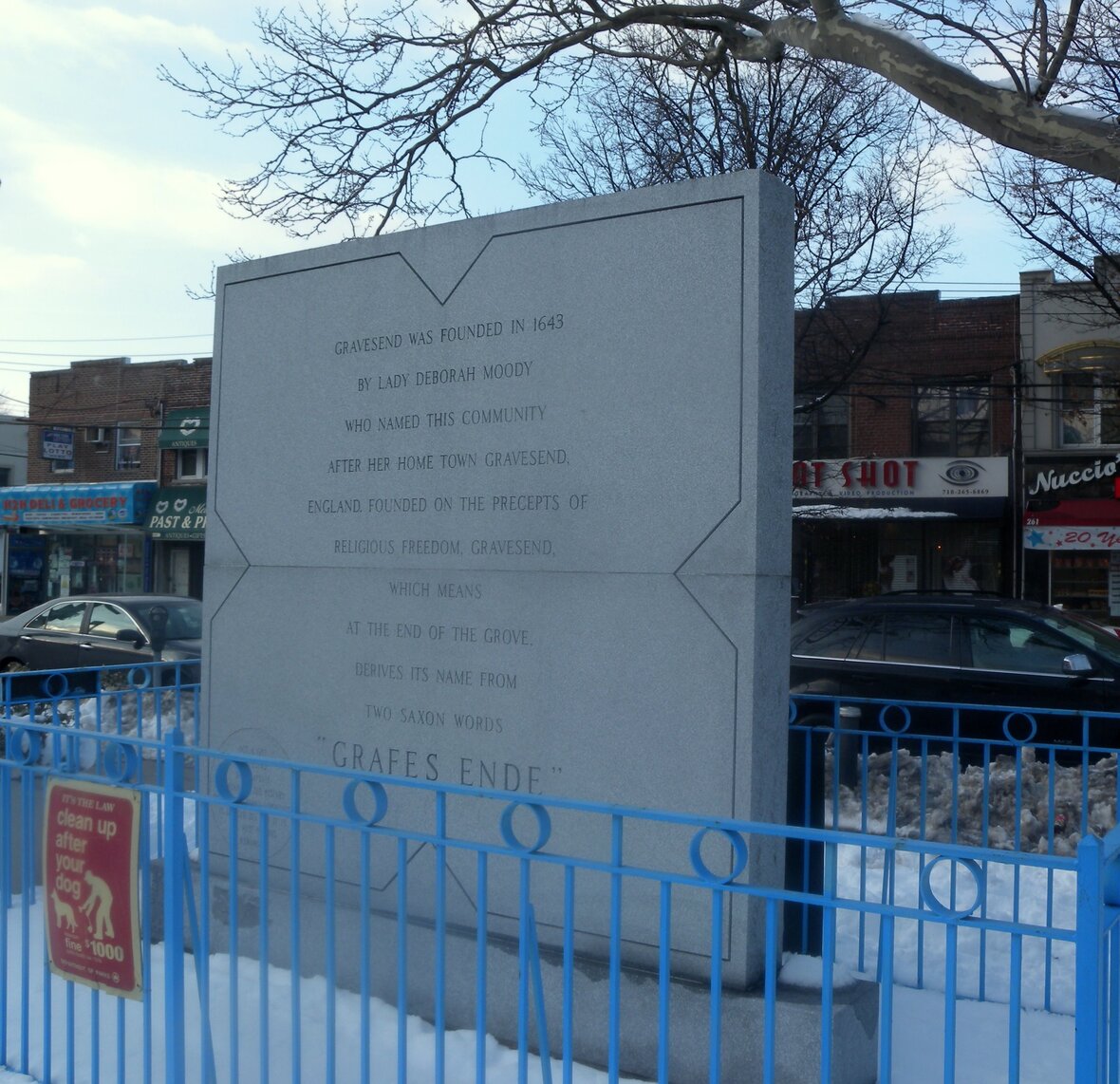
If you walk the streets of Brooklyn today, Lady Moody’s footprint is still visible. The original, unique town square layout she designed remains evident in the modern street grid of Gravesend. Centuries later, she is finally getting her due. The town square has officially been named Lady Moody Square. In 2014, she was posthumously honored in the “Built by Women New York City” competition, and a permanent memorial stands in the square today (pictured above)—a lasting tribute to the “dangerous woman” who refused to bow to conformity and built a sanctuary of her own.
ABE’S PANAMA PLAN
 ABE’S PANAMA PLAN
Since his early political career, Abraham Lincoln had supported the American Colonization Society, a controversial group whose goal was the removal of free blacks from the United States. It and its state affiliates, starting in the 1820s, began settlements in West Africa that would eventually unite to form Liberia.
Lincoln desired to return former slaves to Africa or other tropical regions, with their consent and the accord of the authorities of the country where they were to be settled. He repeatedly expressed his support for colonization, including during the American Civil War.
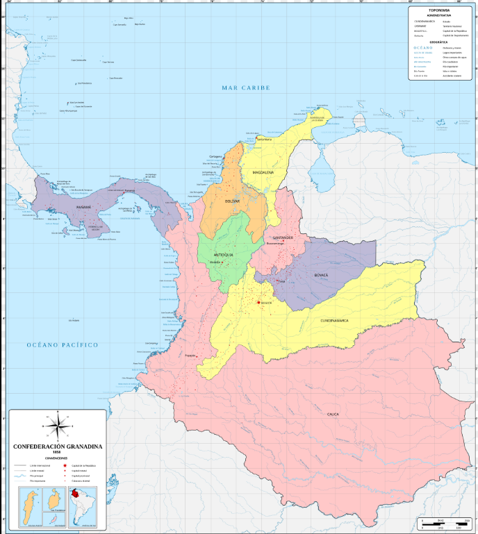
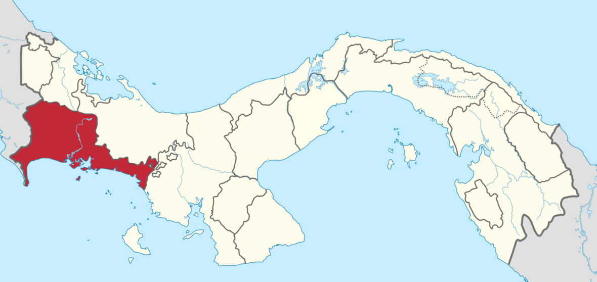
By 1862, Lincoln had decided that Chiriquí Province, then part of the Granadine Confederation but now in Panama (see maps below), would be an ideal location to establish a colony where black people, especially freedmen, could lead better lives than they could in the United States. In August of that year, he invited a group of prominent Africans to the White House to discuss the plan. He stated that the area had “evidence of very rich coal mines…[and] among the finest [harbors] in the world.” African Americans, including Frederick Douglass, were generally firmly opposed to emigration, and the delegation reacted similarly.
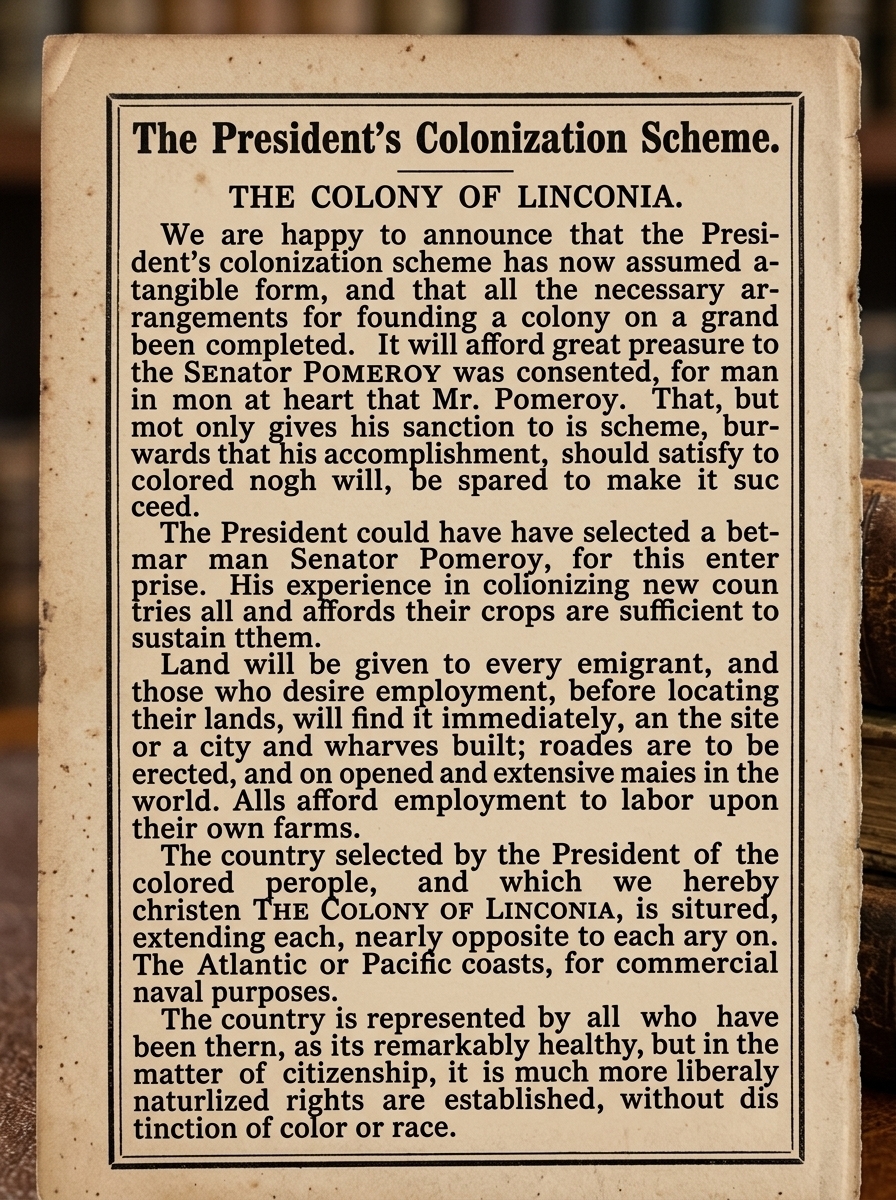
Later that month, The National Republican published an editorial with the title “The Colony of Linconia” (see above), which stated that “the necessary arrangements for founding a colony on a grand scale…have been completed”, with the project being headed by Senator Pomeroy. Pomeroy proposed that 100 African families travel with him to the site as “pioneers” on October 1. In September, Pomeroy received permission from the Chiriquí government and from landowner Ambrose W. Thompson of the Chiriquí Improvement Company.
However, the Central American nations of Costa Rica, Nicaragua, and Honduras felt threatened, and informed Washington that they opposed this plan. Costa Rica had territorial claims in Chiriquí and made a formal complaint. The “representatives of Central America” also considered Pomeroy’s plan to be an example of filibustering, “à la Walker”.
United States Secretary of State William H. Seward informed these nations that the plan would not proceed without their consent, but Lincoln continued to push it forward. By late September, after being advised by Seward of the growing international outrage in Central America, Lincoln decided to abandon the idea, angering Pomeroy, who had already found 500 “pioneers.”
A WHALER’S WORDS
 A WHALER’S WORDS
I mentioned my wife’s ancestor Captain Hezekiah Starbuck’s journey in October 2025 Whaling
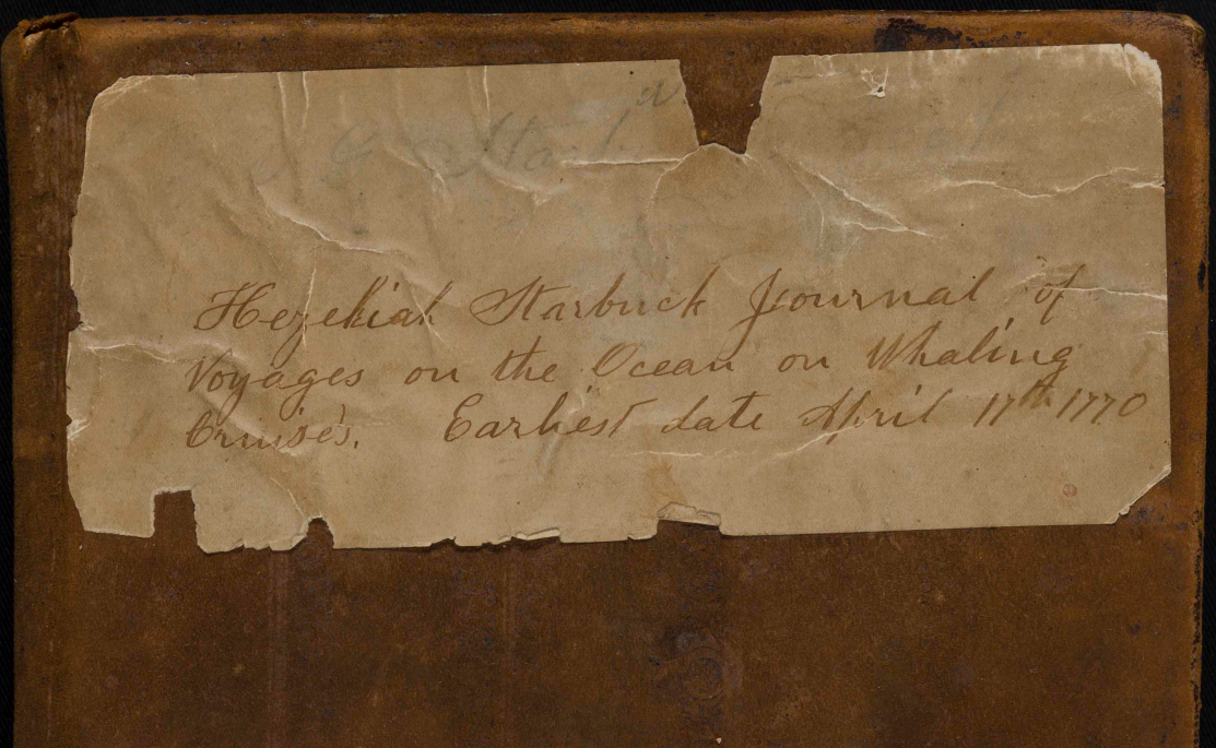
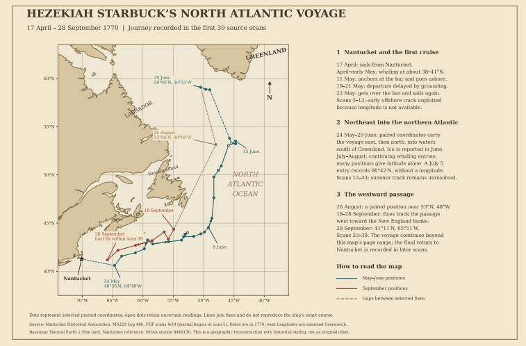
I used AI to transcribe the 400-page journal (cover of file to left) of Starbuck’s 5-year whaling expedition in the Atlantic (see map below) and eventually to the Pacific aboard a whaling ship. This is a perfect job for AI, as the journal has been sitting around for over 250 years, waiting for a volunteer to transcribe it, while 18th-century cursive writing and the ravages of time take their toll. I edited slight spelling errors to ease readability. I will feature a small portion in each edition starting today.
A Journal of our Voyage towards ye Straits of St Davids in the Good Schooner Sea Flower, Barzilial Folger Commander Bound on A whale Crews and with Gods Permission Intermixed with our one endeavor to Return Safe home to our friends A Gain with Good Success
April ye 17th In ye year of our Lord 1770 We weighed Anchor and Set Sail in Nantucket harbor and went to Sea in Company with Gilbert Folger, Jonathan Cartwright and Sundry other Vessels with the wind at W S W And So horld to N W And North with Some Rain And fog So ends the Day with No Land in Sight which makes us feel Quite Lonesome
Wednesday April ye 18th the fore Part of this 24 hours we had A Small Breeze at N N E till 10 of Clock then had fresh winds as Predicted we Run to ye S S W till 12 of Clock then handed our Mainsail & Gibb & Laid under our trisail the Latter Part of the Day Still fresh winds at Noth But Clear weather at 8 of Clock Set our foresail & stasail & Run to ye westward in Company with Gilbert Folger at Mid, had an observe & found our Selves in ye Latts [latitudes] of 39d. 50 N So I Concluded this Days Remarks & am Prete well But the Bigger Part of our Crew is Sea Sick
Thursday April ye 19th the first Part of these 24 hours we had fresh wind at North & so horld to N W & Clear at 4 of Clock Spot with A Sloop from the West Indies with [50 lbs?] & he told us of Divers of our west Indies whale men ye Later Part of ye 24 hours ye wind at west & fresh [as B C?] Plenty of Porpesses [porpoises] So I Conclude this 24 hours
PRESERVE YOUR FAMILY HISTORY, TODAY
 PRESERVE YOUR FAMILY HISTORY, TODAY
Reach out to Dancestors Genealogy. Our genealogists research, discover, and preserve your family history so those stories don’t disappear. Ancestry only gets tougher as time diminishes recall.
No one is getting any younger, and memories fade every year, eventually slipping beyond our ability to recover them. Paper gets thrown in the trash; books survive.
We offer:
Ready to embark on your family history journey?
Call Dan Nelson at 214-914-3598 and get your project started today.
